Mount Aragats
Armenia's highest peak, with Lake Kari below the summits
- Area Aragatsotn
- Type Nature
- Time needed 4h
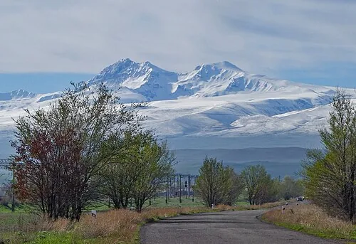
Mount Aragats is Armenia's highest mountain, a four-peaked extinct volcano north-west of Yerevan, with Lake Kari in the crater basin at 3,200 metres. The southern summit is a walk rather than a climb.
Open in the planner →Getting there
About 1h15 from Yerevan to the Lake Kari road head via Byurakan. The road is paved to the lake and is one of the highest driveable roads in the Caucasus.
What you see
Lake Kari, the cosmic ray research station beside it, and the four summits around the crater. From the lake the southern peak, 3,879 m, is a two to three hour walk on a clear path with no technical ground. The northern peak at 4,090 m is a serious undertaking. Amberd fortress sits on the lower slopes on the way up.
What to pair it with
Amberd and Byurakan observatory on the way, Saghmosavank and Hovhannavank on the way back down.
When to go
Late June to September, and this is not flexible — the Lake Kari road is under snow for most of the year and typically clears in the second half of June. Even in August the weather at the lake turns fast.
What is hard about it
Altitude: 3,200 m at the lake with no acclimatisation, and visitors who drive straight up from Yerevan at 1,000 m often get headaches. Weather closes in without warning and the summits hold snow year round. Walkers underestimate the southern peak because it looks close from the lake.
Common questions
Can you drive up Mount Aragats?
Yes, to Lake Kari at 3,200 m, from roughly late June to October.
How hard is the southern summit of Aragats?
A two to three hour walk from Lake Kari, no technical difficulty, but the altitude and the weather make it a real day.
When does the Aragats road open?
Usually in the second half of June. Check locally before setting out.
Nearby
- Amberd FortressCliff-top fortress on the slopes of Mount Aragats
- SaghmosavankMonastery on the rim of the Kasakh canyon
- HovhannavankCanyon-edge monastery with carved portals
- Tegher MonasteryAustere 13th-century monastery on Aragats
- Byurakan ObservatorySoviet-era observatory founded by Viktor Ambartsumian
- Karmravor ChurchTiny 7th-century church with original roof tiles
More of the same kind
- Symphony of StonesBasalt columns lining the Garni gorge like organ pipes
- TsaghkadzorMountain resort with a cable car up Mount Teghenis
- Khosrov Forest ReserveAncient royal hunting reserve of rugged canyons
- JermukSpa town known for its mineral water, gorge and waterfall