Tatev & the deep south
Standing stones, the cable car, the cliff-top monastery and the far south.
- 3 days
- 11 stops
Day 1
Starts from Yerevan · 4h 45m at the sights, 4h 08m travelling · 227 km
Areas: Syunik
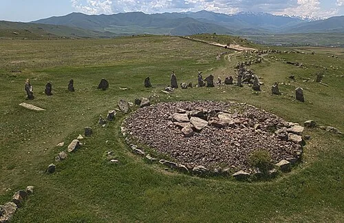
- Karahunj (Zorats Karer) — Prehistoric standing stones, sometimes called Armenian Stonehenge (45m)
- Ughtasar Petroglyphs — Thousands of rock carvings on a volcanic plateau (4h)
Day 2
Starts from Goris · 5h 45m at the sights, 1h 38m travelling · 89 km
Areas: Syunik
- Vorotnavank — Fortified monastery on the Vorotan river (30m)
- Wings of Tatev — Record-breaking 5.7 km reversible cable car to Tatev (1h)
- Tatev Monastery — 9th-century monastery on a cliff above the Vorotan gorge (2h)
- Tatev Great Hermitage — Fortified hermitage in the gorge below Tatev (45m)
- Old Khndzoresk — Cave village linked by a swinging footbridge (1h 30m)
Day 3
Starts from Goris · 5h 20m at the sights, 1h 20m travelling · 74 km
Areas: Syunik
- Goris — Stone town ringed by cave-riddled hoodoos (1h)
- Bgheno-Noravank — Forest church with rich biblical reliefs (40m)
- Vahanavank — 11th-century monastery above Kapan (40m)
- Shikahogh Reserve — Dense southern forest with ancient plane trees (3h)